五邑墟市與河流地圖
Map of
Market Towns + Waterways
in the Five Counties
Map by Jason Wu
First published June 22nd, 2019
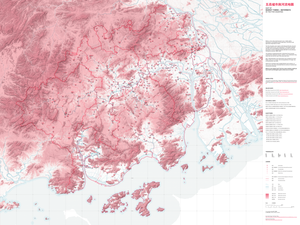
Before a time when land transport was a viable option, populations consolidated along waterways. Commerce and agriculture depended on them.
The Five Counties were regions with disproportionate amounts of arable land for their rural populations. The people migrated, and this area of Guangdong comprising only 3.3% of the total population in China supplied Canada with 82.7% of its Chinese immigrants between 1885-1949.1 This diaspora supplemented their motherland from faraway, sending home imported luxuries, fashions, and architecture; they came and went by the way of the seas and rivers.
Industrialization and urbanization have changed the way in which economy and transportation are carried out. Water routes are no longer vital and populations no longer rely on farming their own food. With this map, you may admire the mountains that isolated dialects and customs, as well as the rivers that connected them to centres of cultural and commercial exchange. Where is your family from? And how many markets would you have had to sail through to get to where you are today?
Click here to access the searchable Google Map.
1 Yuen, Eleanor and Phoebe Chow. “Mapping the Villages & Towns Recorded of Chinese Immigration to Canada from 1885 to 1949.” The University of British Columbia Asian Library. August 2011, https://asian.library.ubc.ca/files/2011/08/Head-Tax-brochure2-1.pdf.
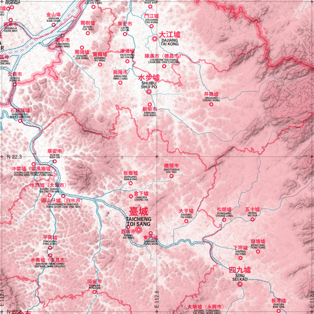
Detail of map showing central region of Taishan.
List of Referenced Online Maps
Baidu Maps. Accessed June 22, 2019. https://maps.baidu.com/.
Google Maps. Accessed June 22, 2019. https://maps.google.com/.
OpenStreetMap. Accessed June 22, 2019. https://www.openstreetmap.org/.
Tianditu. Accessed June 22, 2019. https://map.tianditu.gov.cn/.
List of Referenced Historical Maps
China, 1:250:000. (Washington, D.C.: US Army Map Service, 1954).
Kwangtung, 1:50,000. (Washington, D.C.: US Survey Department, 1958).
譚啓鈞,林克雄:《台山縣最新詳細地圖》(中華民國二十四年「1935」台城西華印書館印版)。
吳槐廷:《新台開恩四邑地圖》(「年份不詳」永和興藥莊印版)。
List of Referenced Gazetteers
賈雒英等:《新會縣志》(康熙二十九年「1690」刊本)。
周書等:《恩平縣志》(乾隆三十一年「1766」刊本)。
王文驤等:《開平縣志》(道光三年「1823」刊本)。
楊學顏等:《恩平縣志》(道光五年「1825」刊本)。
張深等:《新寧縣志》(道光十九年「1839」刊本)。
林星章等:《新會縣志》(道光二十一年「1841」刊本)。
何福海等:《新甯縣志》(光緒十九年「1893」刊本)。
余丕承等:《恩平縣志》(中華民國二十三年「1934」聖堂光華書局承印本)。
李奕楫著:《海宴郷土史》(中華民國四十九年「1960」九龍永德印務印本)。
林永江:《江門市地名志》(廣州:廣東省地圖出版社,1991年)。
《新會縣志》(廣州:廣東省人民出版社,1995年)。
《台山縣志》(廣州:廣東省人民出版社,1995年)。
《鶴山縣志》(廣州:廣東省人民出版社,2001年)。
《開平縣志》(廣州:中華書局,2002年)。
《恩平縣志》(北京:方志出版社,2004年)。